
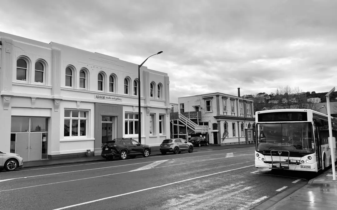
Anthonie Tonnon is best known as an award-winning songwriter and performer, but over the past decade he’s also built a reputation as one of Aotearoa’s most thoughtful public transport advocates. He currently operates Whanganui’s historic Durie Hill Elevator and has worked in an advocacy capacity with councils on efforts to improve public transport, most recently Whanganui’s revamped bus network.
We invited Anthonie to the Black Pine studio for a cuppa and threw him some questions about the overlap between architecture and public transport, and to discuss how the design of our cities, suburbs, streets, infrastructure and transport services influence the way we live, move, and connect with one another.
Note: This interview has been lightly edited for clarity.
Public transport is often seen as infrastructure rather than design. How do you see it contributing to the architectural identity of a city like Whanganui?
I think there’s often a misunderstanding about public transport being infrastructure, with an overemphasis on the infrastructure part.
If you take roads or cycleways or walking paths, these are human-led infrastructure – things people go on. Public transport is different because the most important factor is the service. You can have the fanciest bus stop or the highest speed train you like but if there’s no bus or train on a Sunday, for that day, the service effectively doesn’t exist. That’s a big challenge because it’s a different way of thinking about the services our cities need, and that also contributes to architectural identity.
From quite early on, Whanganui was built around a tram network which helped grow our suburbs like Gonville, Castlecliff, Whanganui East, the upper ends of Aramoho. We’ve inherited this nice legacy where our major destinations, our little groups of suburban shops, and particularly our housing density, are focused on those old tram lines.
What I encourage cities to do, particularly regional cities, when they’re thinking about how to revive or improve public transport, is look at what was done in the 1940s/50s when public transport was at a high. It might be that the old system can explain some things about how a city works and maybe offer a head start on what the future needs. This is more and less true, depending on which city you’re in. For example, in Auckland there’s commonality between the modern public transport network and the old tram network. The city grew hugely after 1956 when the tramlines came out, so they had to get very good at designing a public transport network for a second-half of the 20th century urban form.
In Whanganui’s case, of all the cities in New Zealand, we still probably have the closest urban form to what we had in 1940. A lot of our larger and more impressive buildings are placed in spots that are easily accessed by public transport, and these are things we need to think about when we plan and build.
A good example of something that’s become tricky for us is the library. It was built in the 1980s and nobody was thinking about a bus service, so they put the library on top of the hill. Distance-wise, it’s not a long walk from the nearest bus stop to the library, but we now have an ageing population, lots of people dependent on the library’s services, and it might be difficult for them to walk even 200 metres on an uphill incline. That’s not the worst offender in this realm, but it’s an example of something that could have been thought about.
That said, Whanganui still has a huge opportunity because we haven’t made as many mistakes as other places, so we’ve got the chance to not make them in future.
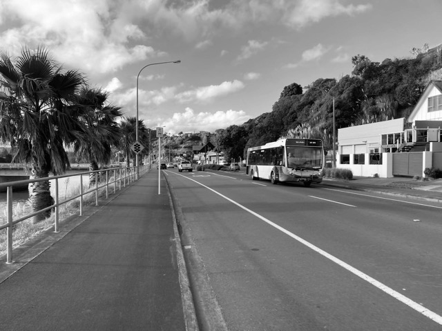
The Durie Hill Elevator is a heritage landmark and a functioning piece of public transport. What lessons do you think it offers about integrating utility, history, and civic identity?
The Durie Hill Elevator is amazing in these aspects because not only is it a great attraction, it’s also a functioning public transport service, which makes it so much more interesting.
Personally, when I go to a new city I don’t like to feel like I’m in Disneyland, getting shepherded to the place all the tourists go and we’re just taking turns going around on a ride. When tourists come here, I think they’re delighted because they get to walk this amazing tunnel and have a memorable elevator ride, but the icing on the cake is they’re doing it with the lady wheeling her groceries, or they might have to share the elevator with a couple of kids in uniform with their bikes. So, for the duration of their tunnel walk and elevator ride, they’re part of the community. That’s a priceless experience we’re giving people.
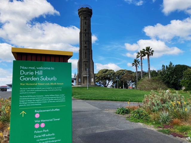
But it’s also a window into Whanganui’s history as a city, how prosperous we were in the 1920s and the ambition to build a city that worked well. We’re a nationally significant place to talk about spatial planning, how you think about where people live and how they’re going to get around. Today, there’s such a big conversation about transit-oriented development, this idea of thinking about what public transport route people are going to take before you plunk all the houses there, rather than putting in a whole bunch of houses then letting the bus planners figure out how to solve the problem later.
The development of Durie Hill is a great example of this. They built the transport first, they built the elevator, then they built their suburb around it. And they designed it as a cul-de-sac suburb, which these days we normally associate with cars. But here they made it with great walkability, as a planned garden suburb, with good pedestrian cut throughs. A suburb like Durie Hill can actually tell you a lot about New Zealand’s approach to building housing.
Whanganui’s new bus network has seen a strong early response. What do you think this reveals about how people engage with well-planned transport systems?
What I’ve been most impressed with is the way early users have treated it as a network. For context, we’ve done this [network rollout] in stages where we first introduced the high frequency trial, The Tide, that went every 20 minutes. It was just one route, and it only went past about 30% of Whanganui’s population, which is actually still high for a single route. During that trial I was hoping we’d hit 10,000 trips a month. It started at 5,000 and by the end was consistently around 9,000 boardings on that route. But we had nine other routes, and they only went every two hours, sometimes less, and those routes took 1,000 or less boardings a month. Some only took a few hundred.
We’ve completely redone the network so that instead of nine or ten regular routes we’ve gone to five streamlined routes, with the bulk of the work done by two frequent routes running every 20 minutes. Now, where we were trying to get 10,000 trips on one route, we’ve had more than 10,000 on both routes, which is fantastic. We still have less use on the other three, but that’s because they only go every hour and there’s always a route change between them.
The focus shifted to running what we call ridership-focused routes, which are the most frequent and direct. You’re trying to run them in as straight a line as possible because the number one thing people respond to for a good bus route is the frequency, two is the frequency, three is frequency, and maybe four or five is how direct is it. But frequency is the most expensive part, so every extra kilometre is valuable when trying to get the most out of them. You achieve this by making the route go past lots of housing, or an important destination like the hospital, Splash Centre, Kowhai Park, or supermarkets. And you try to utilise grid-based streets because they house so many more people compared with a cul-de-sac, and more people can be within walking distance to a bus stop.
But coming back to my original point, what you really want are those network effects. If you’re just thinking about a single bus route, increasing the frequency won’t automatically increase the number of people using that route, at least not right away. Normally, if you double the frequency, you’ll expect a little bit less than double the patronage, and that’s a hard problem because you might be doubling the budget to not double the number of riders.
The network is what makes the difference. If you can change things so someone on one route can easily transfer to another, you can get network effects which means that across all the routes you can more than double the budget, and that’s what we’ve achieved. In our first month we did well because fares were free, but in the following months we had a 70% increase in use against a 50% increase in budget.
That suggests people are transferring and not solely thinking about the route they live on. They understand that if they need to get from point A to B, wherever those points are, there’s some way to do it using public transport and a little bit of walking.
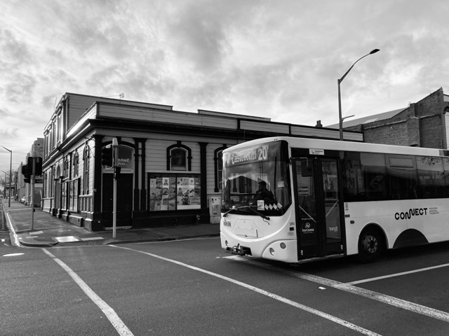
From an urban design perspective, what role do bus stops, shelters, and routes play in shaping how people experience the city at street level?
This is an interesting one, and again I first go back to the level of service and the practical role of frequency. It’s useful to consider the math behind average travel time, which is the time it takes to be on the bus, plus the time it takes to wait for the bus, because that’s what lets users plan and make it work for them.
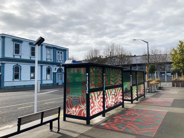
The bus stops and shelters are really important, but they can also be a challenge in terms of the role they play. I’ve been looking at cities like Wellington and Auckland which have worked really hard on their shelters, the way they’re laid out, and you can see a clever kind of infrastructure that might incorporate a good bike path and a shelter in the same spot. They’re well looked after, have good information, they’re a place to express some well thought out visual language or wayfinding. It’s pretty cool as a public transport user when you can go to a city, look at a street and instantly recognise there’s a system there.
Another example I quite like is the way Dunedin is doing it because the bus stops speak to their history. Like us, they have lots of historic tram shelters and in the last 5-10 years have done a really good job making them look a bit better. But even with building new shelters, their approach is like, ‘Let’s try to retain this old language, even if it’s a bit stuffy and Victorian looking, because at least it’s a head start on what was already there.’
On the complete other end of the spectrum, there’s a city of around 30,000 residents in Switzerland that has such a frequent system that they have barely any stop infrastructure because you’re never waiting that long.
So, the question is whether a local council should double or triple or quadruple the budget for bus stops and shelters to catch up to the standards other cities are setting, or do you go the Swiss model where you just make the bus so frequent that you need very minimal infrastructure? I think the answer is probably somewhere in between.
Unfortunately, we’re in a really hard time for finding funding, so I’d really encourage locals here in Whanganui to take a bit of ownership. If you’ve got a bus stop on your street, if you’re keen on having the bus, adopt that bus stop. If there’s graffiti, maybe get some turps and wipe it off. If there’s a bit of rubbish, could you pick it up? If you want it improved, perhaps there’s some way you could help do that, kind of in the same way you see little book libraries on street corners and things like that.
[Editor’s note: we can confirm Anthonie walks the talk and is often spotted tidying up around Whanganui’s main transport hub].
Accessibility is a key aspect of both transport and design. How can cities ensure their public transport systems are inclusive for all users, regardless of age or ability?
Public transport would work a lot better if our streets were more accessible and easier to walk or wheel yourself across the road and not worry about a car coming. I think there’s a real opportunity to think more holistically about our streets, and public transport is a great way to do that.
There are really two kinds of transport. There’s anywhere-to-anywhere transport where you start at A and get to B, however you can – car, bike, walk, whatever. In those situations, you need as many paths as possible because frequency doesn’t matter – you just set off whenever you want. To do that kind of transport, having multiple paths on a bike or on foot doesn’t actually use much space. Think of lots of people crossing a city square; you can have thousands of movements on very simple infrastructure – an open cobbled space, or something like it.
But trying to make anywhere-to-anywhere transport by car is incredibly resource intensive. We have to build and maintain so many roads – not just arterial roads, but connector roads and suburban streets, and all to a high standard. When I was a kid, a lot of the streets in my suburb were asphalt which was perfect for skateboarding, but you notice now we’re struggling with the burden of looking after all these streets, and a lot of our suburban streets are chip sealed now. That’s just one small way we’re feeling the pain of trying to have what used to be the quality of transit option for a walker or a cyclist or someone on a wheelchair, and we’re trying to do that with cars.
But public transport, combined with good walkability, offers us something really interesting. If you create a simple transport grid, say 800 metres apart, everybody’s a 400 metre walk or wheel to a public transport stop, and you can potentially serve a whole city without the need for arterial and secondary or third layers of roads. Public transport allows you to move lots of people with fewer roads, and I think there’s an opportunity there for a future where it’s easier and more accessible to walk or wheel yourself a short distance safely without fear of interacting badly with a car.
The way I love to think about this is that public transport is an extension of our walking network and our footpaths. It’s like a travelator: if you can get someone to walk a short distance to the nearest bus stop, the bus is like this travelator that picks you up and zooms you over to another walkable catchment somewhere else on the other side of town. When it works like that it can be a truly wonderful thing.
Sure, some people can’t make that walk, but if you have a great system it means you’ve got less cars, particularly on our secondary and suburban roads. That makes it safer and easier for cyclists and those who need mobility services or wheelchairs, but it also means space is left for things like ambulances and fire trucks. I think that also opens opportunities to save a lot of money on the huge amount of infrastructure we service.
Anthonie will be performing his new show, Cinematographer, at the Royal Whanganui Opera House as part of the inaugural Festival of Design Aotearoa. Black Pine Architects is also hosting an Open Day during the festival — check out the full event schedule and support your local designers!